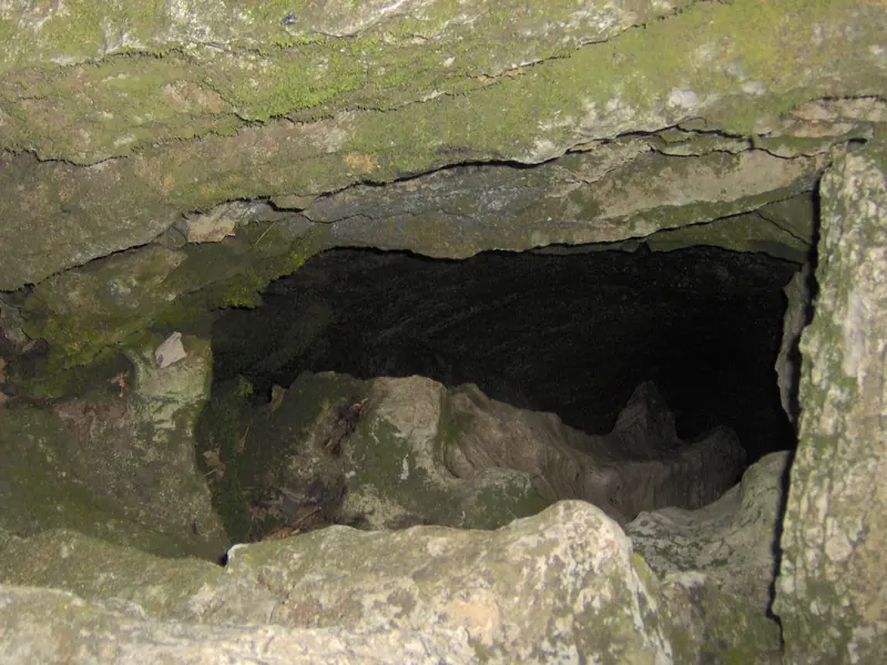
Clarksville sits on the Highland Rim, and the Rim is limestone almost all the way down. Rain picks up a little acid on its way through the soil, and over thousands of years it opens cracks, caves and voids in that rock. When the soil roof over a void gets too thin, the ground drops. This page puts the public numbers behind that in one place and sets out what Tennessee's agencies say a homeowner should do.
What rock is under a Clarksville house?
Mostly Mississippian limestone. A USGS karst study of Tennessee states that "the entire Highland Rim in Tennessee is underlain by carbonate rocks of Mississippian age", naming the Ste. Genevieve and St. Louis limestones as the units where sinkholes are most common. The USGS state geologic map lists Montgomery County among the counties where the Ste. Genevieve Limestone crops out: gray, slightly oolitic and cherty, with a maximum preserved thickness of 70 feet in the western Rim.
Rock like this is what geologists call karst. TEMA describes karst country as a landscape of caves, sinkholes, fissures and underground streams, formed where rain is plentiful and the bedrock dissolves. Clarksville gets plenty of rain, which is the next number.
How does a sinkhole actually form?
Water does the work. The USGS explains that in soluble rock such as limestone, groundwater slowly opens spaces underground while the surface stays intact, until there is not enough support left and the land gives way. Some sinkholes sag over years; the USGS says cover-collapse sinkholes in clay-rich soil can develop over a matter of hours. Sizes run from less than a foot deep to more than 100 feet.
Tennessee is one of seven states the USGS names where sinkhole damage tends to be greatest. The agency also notes that new sinkholes have been linked to changes people make, including changes to the way water drains off the land.
The USGS clip above is a short geology explainer. It also points out that broken water and sewer lines can wash soil into voids, which is one reason a leak under a yard is worth chasing down early; our page on checking the meter for a leak shows how.
Is there a mapped sinkhole in town?
Yes, at least one has its own federal site number. The USGS keeps a monitoring location called Hospital Sink Hole at Clarksville, site 03436138, a sinkhole that takes storm runoff from the city. Its record holds 49 water-quality samples taken between February and October 1988.
What should you do if a hole opens in the yard?
Keep people and pets well back from it first. The ground at the edge of an opening may be undercut, so do not stand at the rim to look in. TEMA's homeowner advice is short and blunt:
- If a sinkhole forms under or near a house, do not stay in the house.
- If one develops under a structure, the foundation should be shored up as quickly as possible.
- Get a professional geologist who knows karst, and an engineer experienced in sinkhole repair.
- Before buying, avoid a house built on a filled sinkhole, and look for shallow depressions and arch-shaped cracks in the soil.
Can you fill a sinkhole or drain water into it?
Not without checking with TDEC first. Changing a sinkhole, or sending storm water into the ground through one, falls under the state's underground injection rules. TDEC's Underground Injection Control page lists form CN-1106 for "modification of a karst feature" and for storm water discharge to the subsurface. A downspout, sump line or driveway drain routed into a sinkhole is the kind of project that form covers.
TDEC says fees are paid online but does not list the amounts on that page. A county or city drainage review may also apply, so call the local codes office before you regrade or pipe anything.
How do sinkholes connect to your plumbing?
Through water you control. A sewer lateral or supply line that leaks into the ground adds water where the soil may already be loose, and gutters that dump at one corner do the same. Keeping roof water and pipe leaks away from depressions is ordinary upkeep; if a leak is underground, a licensed plumber is the right call. Rain and river levels matter too: see the Cumberland River gauge numbers, and for homes on wells or septic, our pages on well water and septic in the county, since karst lets surface water reach groundwater quickly.
Does the city publish a sinkhole map?
We found no City of Clarksville sinkhole map or sinkhole setback ordinance on the pages we checked. The geology maps above show where the rock is, not where the next hole will open. For the wider set of house numbers, the pipes shelf collects freeze, river and ground pages.
Behind these numbers
The rock facts come from two USGS sources: a 1997 karst report and the state geologic map unit for the Ste. Genevieve Limestone. The rainfall chart uses NOAA's 1991–2020 normals for the Clarksville WWTP station. TEMA's advice was taken from an archived copy of June 2026 because the live page refused us; TDEC's review times come from a page that shows no date. A 1988 USGS report on the hospital sinkhole is a scanned image, so we did not use its figures. All checked 6 Nov 2026.
Questions people ask
Is all of Clarksville on karst?
The USGS describes the whole Tennessee Highland Rim, which includes the Clarksville area, as underlain by Mississippian carbonate rock. That does not mean every lot has a void under it. It means the rock that forms sinkholes is present across the area.
Can fill dirt go into a small sinkhole?
TDEC treats modifying a karst feature as something that may need its Class V authorization (form CN-1106). Ask TDEC before filling, grading or piping water into any depression. A geologist can also tell you whether fill alone will hold.
What signs matter before buying a house?
TEMA names shallow depressions and arch-shaped cracks in the soil, and damage to nearby buildings. It also advises against buying a structure built over a filled sinkhole. Asking the seller directly is part of its advice.
Who checks a sinkhole near a foundation?
TEMA points to a professional geologist with karst experience and an engineer experienced in sinkhole remediation. Until they have looked, keep people out of the house if the hole is under or near it.
Does the rain total matter?
Water is what dissolves limestone and moves soil into voids. Clarksville's normal rainfall is 53.50 inches a year, with May the wettest month at 5.59 inches.
Sources
- USGS — WRIR 97-4097, Karst regions of Tennessee · Highland Rim carbonate rock, sinkhole-prone limestones · checked 6 Nov 2026
- USGS — State Geologic Map Compilation, St. Genevieve Limestone (TNMsg;3) · rock description, 70-ft maximum thickness, Montgomery County listing · checked 6 Nov 2026
- USGS Water Science School — Sinkholes · how sinkholes form, size range, states with most damage · checked 6 Nov 2026
- USGS — Monitoring location 03436138, Hospital Sink Hole at Clarksville · site name and 1988 sample record · checked 6 Nov 2026
- NOAA NCEI — 1991–2020 monthly normals, USC00401790 · monthly and annual rainfall · checked 6 Nov 2026
- TDEC — Underground Injection Control Permit · form CN-1106 and review times · checked 6 Nov 2026
- TEMA — Geologic threats · homeowner sinkhole advice, archived copy of 20 Jun 2026 · checked 6 Nov 2026